
The sixteen hamlets at the forest's edge.
A cluster of sixteen villages and small hamlets at the northern edge of Bannerghatta National Park, in the undulating country south of Bengaluru — a working agrarian panchayat that has shaped, and been shaped by, four decades of contact with both the forest and the city.
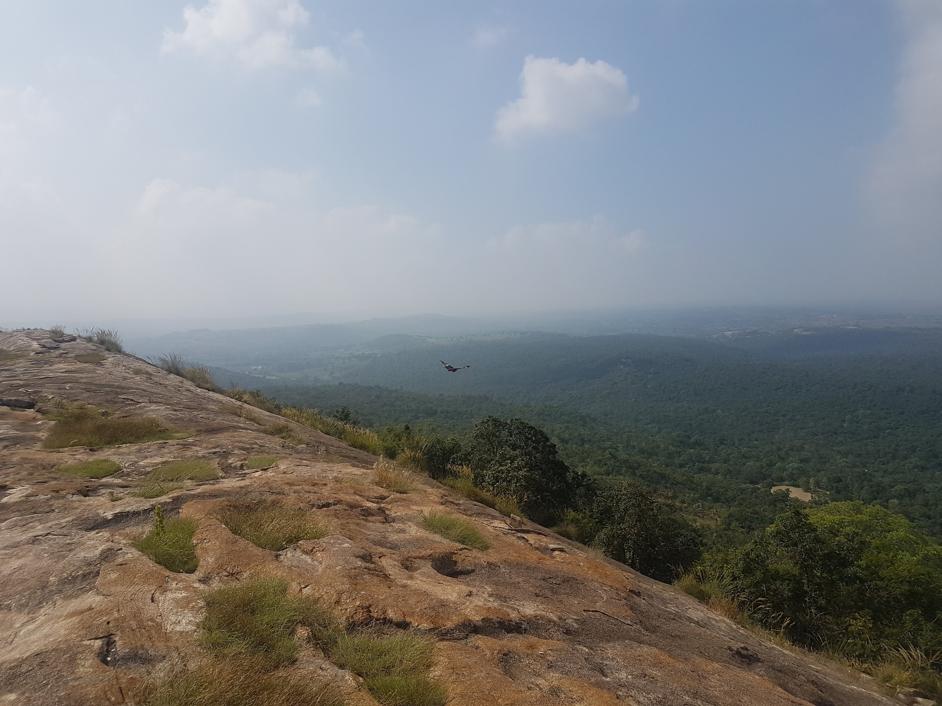
Bannerghatta is one of India's protected forests, sitting where the Western and Eastern Ghats meet — a dry deciduous landscape that forms part of a major elephant corridor. The panchayat sits along its northern buffer.
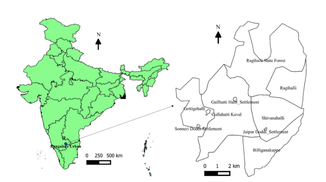
The panchayat lies along the northern buffer of Bannerghatta National Park — a 245-square-kilometre stretch of dry deciduous forest that sits at an unusual ecological junction, where the Western Ghats meet the Eastern Ghats. The park is part of an elephant corridor of national significance.
The Ragihalli panchayat is a cluster of sixteen villages and hamlets. Ragihalli is the largest of these, followed by Shivanahalli.
The land is undulating, rising from about 700 metres to 950 metres above sea level. The soil is thin in many places, with rock close to the surface. Annual rainfall is modest — between 600 and 700 millimetres in a typical year — and falls mostly in a short monsoon window, which shapes nearly everything about how life is organised here.
- Ragihalli
- Shivanahalli
- Annayyana Doddi
- Basavana Doddi
- Gudlayyana Doddi
- Jaipura Doddi
- Kariyappana Doddi
- Kateri Doddi
- Koratagere Doddi
- Moodlayyana Doddi
- Muninanjappana Doddi
- Ontemarana Doddi
- Ramanayakana Doddi
- Sevanayakana Doddi
- Sollepura Doddi (now Vivekanandapura)
- Ujinappana Doddi
The panchayat takes its name from its principal crop. Ragi — finger millet — is the staple grown across the region, alongside oil seeds such as castor, grains like buckwheat and kidney beans, and small quantities of grams, vegetables, and flowers in those few fields that have irrigation.
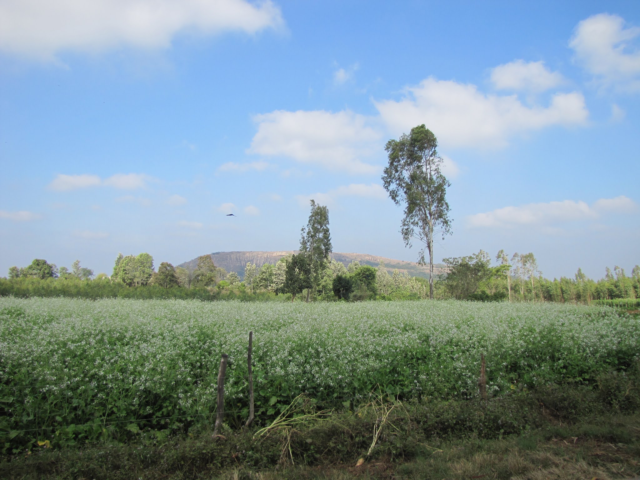
About 440 hectares of crop land sits within the panchayat, of which only twenty or so are irrigated. The rest depends entirely on the monsoon. In years where the rains are late or short, fields are left fallow, and many farmers who once grew Ragi have stopped.
Some farmers also keep mulberry plots for sericulture, and a few have moved into commercial floriculture for the Bengaluru market. Livestock remains widely kept — cows, sheep, goats, hens — though fodder availability through the year is a recurring constraint.
If there is a single thread that runs through the agricultural, domestic, and ecological life of these hamlets, it is water — its scarcity, its timing, and the labour required to make it last.
By 2015, the IISc survey found groundwater in the panchayat's borewells had fallen to about 700 feet, with some wells at 1,000 feet. Domestic water reaches the hamlets through a single overhead tank serving all sixteen, with taps at clusters of houses opened once every two or three days. Households store what they can in underground sumps and drums.
There are a handful of lakes and constructed tanks across the panchayat — Ragihalli Lake and Shivanahalli Lake among them. Many are not maintained. The work of watershed management — recharge pits, percolation tanks, check dams, replanting of native grasses and trees — is what restores them, and what restores groundwater alongside.
"Annual rainfall of 600–700mm is adequate to meet the basic needs — domestic, agriculture, horticulture — which entails rainwater harvesting through tanks and recharge pits, apart from interventions at micro-watershed levels." IISc Smart Village Framework · ENVIS Technical Report 90, 2015
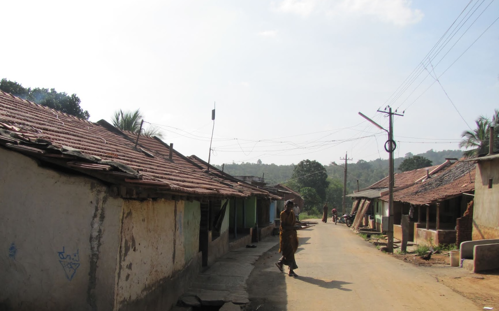
For sixteen hamlets and three thousand people, public infrastructure has historically been thin. The 2015 survey recorded only two functioning schools across the panchayat, no high school, and a single ayurvedic health centre with a part-time visiting doctor. The nearest Primary Health Centre is about ten kilometres away — far enough that the lack of public transport puts it out of reach for many.
The panchayat sits where several long pressures meet. The most pervasive is the steady southward growth of Bangalore — a city that has roughly doubled in population since the early 1990s, with its industrial and technology corridors pushing closer to the park year by year. What used to be a long bus ride is now, for many young people in the panchayat, a daily commute.
To the south is the national park — a protected forest that brings elephants, leopards, and wild pigs into regular contact with farmland. Fields close to the park boundary are sometimes left fallow because of the risk of crop raids. The Mission's afforestation work in Brahmananda Vana, immediately adjacent, was begun in part to widen the buffer that absorbs human–animal conflict, and to reduce dependence on the forest for firewood.
The way the park is governed shapes life around it. Indian forest law treats protected areas as the responsibility of the state, with sharp limits on what surrounding communities can take from them — firewood, fodder, minor produce, grazing access. The intent is conservation; the lived effect for villages whose livelihoods were once partly woven into the forest is a slow narrowing of options.
And across the panchayat, as across most of rural Karnataka, young people are leaving — for jobs in the industrial corridors of Bommasandra and Jigani, for shopfront work in nearby towns.
This page does not list every problem to make a case. It sets out the conditions of a real, named place — sixteen hamlets, three thousand people, an undulating dry-deciduous landscape on the edge of a national park.
The Mission has lived inside this place for forty years. Most of what is described elsewhere on this site — the schools, the Sunday clinics, the watershed work, the dairy support, the women's self-help groups, the regenerated forest — is the slow, patient response to the conditions described here. Not as charity, but as participation.
The panchayat is changing. Some of what the 2015 survey recorded is now better; some is worse. What hasn't changed is that the work is set in this specific place, with these specific neighbours, and that fact shapes everything.
The work, across four decades.
This page describes the place. The main site walks through what the Mission has done within it — schools, healthcare, livelihoods, and the regenerated forest of Brahmananda Vana.
Back to the main site